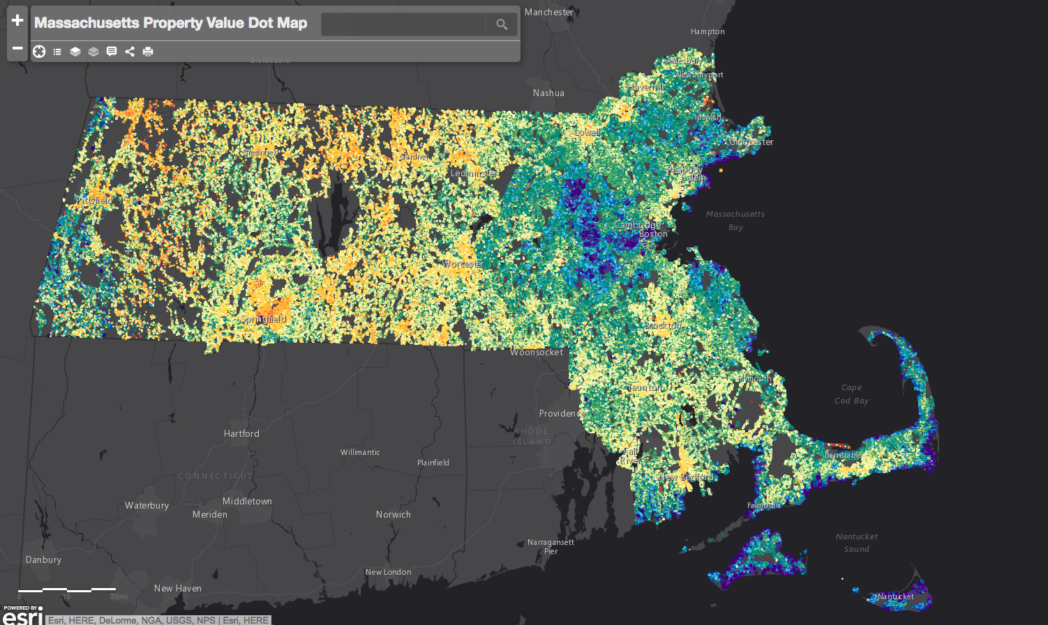
An interactive map with over 2.5 million data points shows a property value visualization of the whole state of Massachusetts. Created by Aaron Doucett, a GIS analyst in Cambridge, the map consists of individual dots that each represent a land parcel. From each dot you can see, total property value, price per square foot and […]
Read MoreInsights
Viewing posts from: Property Value
Recent Posts
- SOLD | 105-109 Charles Street, Mixed Use Asset in Beacon Hill, Boston, MA
- Boston Realty Advisors Offers 399 Washington Street for Sale.
- Empty since 2006, this downtown building is back on the market
- Corporate Signs Are Proliferating on Boston Office Towers. Here’s Why.
- SOLD | 2 Joy Street | 13 Unit Brownstone | Beacon Hill, Boston, MA
Categories
- Debt & Equity
- Non Profit
- Transacting
- E-commerce
- Technology
- Construction
- Transit
- Modular Housing
- Restaurants
- Ghost Kitchen
- BRA Residential
- Banks
- Non-Profit
- Residential
- Boston Commercial Real Estate
- New Developments
- Property Management
- Nantucket
- Rhode Island
- Exclusive
- Minute
- Research
- BRA Ignite
- Pier 4
- Urban
- Capital Markets
- Events
- News
- Land
- Retail
- Downtown Office
- Suburban Office
- Multi-Family
- Hospitality
- Financing
- Uncategorized
Archives
- July 2024
- May 2024
- April 2024
- March 2024
- November 2023
- January 2023
- December 2022
- August 2022
- July 2022
- June 2022
- April 2022
- March 2022
- February 2022
- January 2022
- December 2021
- November 2021
- October 2021
- September 2021
- August 2021
- July 2021
- June 2021
- May 2021
- April 2021
- March 2021
- January 2021
- December 2020
- November 2020
- October 2020
- September 2020
- August 2020
- July 2020
- June 2020
- May 2020
- April 2020
- March 2020
- February 2020
- January 2020
- December 2019
- November 2019
- August 2019
- April 2019
- March 2019
- February 2019
- December 2018
- October 2018
- September 2018
- August 2018
- July 2018
- June 2018
- May 2018
- April 2018
- January 2018
- December 2017
- November 2017
- October 2017
- September 2017
- August 2017
- June 2017
- September 2016
- August 2016
- July 2016
- June 2016
- May 2016
- April 2016
- March 2016


